- You are here:
- Home
- Tour Operators
- Shipungo Safari & Tours
- Company Profile

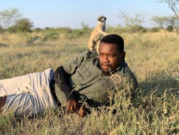

Makgadikgadi Pans, Botswana
Shipungo Safari & Tours
- Office In:
- Size:
- 10-20 employees (Founded in 2015)
- Tour Types:
- Custom budget & mid-range tours that can start every day
- Destinations:
-
BW
- Price Range:
- $200 to $360 ppper person per day (USD, excl. int'l flights)

Shipungo Safari & Tours
Company Profile
WELCOME TO SHIPUNGO SAFARI AND TOURS
Shipungo Safari & Tours has a sizzling spot when it comes to operating a mobile safari company, the company will fulfill this spot and further boost Maun's economic growth for sustainable tourist attractions around the country.
We offer day and overnight trips, Mokoro trips, Scenic Flights, Mobile Safari, and Boat Cruise. We cover Moremi Game Reserve, Central Kalahari, Nxai pan, Makgadikgadi pan, Chobe national park, and scheduled trips in both Zimbabwe and Namibia.
OKAVANGO DELTA
The Okavango Delta is a large low gradient alluvial fan or ‘Inland Delta’ located in north-western Botswana. The area includes permanent swamps which cover approximately 600,000 ha along with up to 1.2m ha of seasonally flooded grassland.
The inscribed World Heritage property encompasses an area of 2,023,590 ha with a buffer zone of 2,286,630 ha. The Okavango Delta is one of very few large inland delta systems without an outlet to the sea, known as an endorheic delta, its waters drain instead into the desert sands of the Kalahari Basin. It is Africa’s third-largest alluvial fan and the continent’s largest endorheic delta. Furthermore, it is in a near-pristine state being a largely untransformed wetland system. The biota has uniquely adapted their growth and reproductive behavior, particularly the flooded grassland biota, to be timed with the arrival of floodwater in the dry, winter season of Botswana.
CHOBE NATIONAL PARK
Whether arriving by air or road, the first glimpse of the river – deep and dazzling in the sandy terrain – is always breathtaking. It appears as a swathe of brilliant, peacock blue ribbon, winding its way through the tiny town of Kasane, and ensuing wilderness – the Chobe National Park.
Undoubtedly one of Africa’s most beautiful rivers, the Chobe supports a diversity and concentration of wildlife unparalleled anywhere else in the country.
Established in 1968, the park covers approximately 11 7 00 sq km, encompassing floodplains, swamps, and woodland. The Chobe River forms its northern boundary. There are four distinct geographical areas in the park: the Chobe Riverfront, the Ngwezumba pans, Savuté, and Linyanti.
The most accessible and frequently visited of Botswana’s big game country, the Chobe Riverfront is most famous for its large herds of elephants and cape Buffalo, which during the dry winter months converge upon the river to drink.
During this season, on an afternoon game drive, you may see hundreds of elephants at one time. You may be surrounded by elephants, as the main Serondella road becomes impassable and scores of family herds cross the main road to make their way to the river to drink, bathe and play.
Driving the loops that hug the river’s edge, you may see up to 15 different species of animals on any one game drive, including waterbuck, lechwe, puku (this is the only part of Botswana where they can be seen), giraffe, kudu, roan and sable, impala, warthog, bushbuck, monkeys, and baboons, along with the accompanying predators' lion, leopard, hyena, and jackal.
Take a river cruise – and you’ll experience the park, and the animals, from another vantage point. Here you’ll get up close and personal with hippo, crocodile, and a mind-boggling array of water birds.
Over 460 bird species have been recorded in the park, making it one of Africa’s premier venues for bird Safaris. Common species to be seen include the Sacred ibis, Egyptian Geese, the ubiquitous cormorants and darters, Spur-winged Geese, Pel's Fishing Owl, carmine Bee-eaters, most members of the kingfisher family, all the rollers, the unmistakable Fish Eagle, the Martial Eagle, and many members of the stork family.
The Chobe River rises in the northern Angolan highlands and travels enormous distances before it reaches Botswana at Ngoma. Like the Okavango and Zambezi rivers, the Chobe’s course is affected by fault lines that are extensions of the Great Rift Valley. These three mighty rivers carry more water than all other rivers in Southern Africa.
Ngwenzumba Pans
The Ngwezumba pans lie approximately 70 km south of the Chobe River and comprise a large complex of clay pans, surrounded by mophane woodlands and grassland plains.
During the rainy season, the pans fill with water, then attracting wildlife that moves away from the permanent water sources of the Linyanti and Chobe Rivers.
Linyanti
During the dry winter months, game-viewing at the permanent waters of the Linyanti can be excellent.
The area that falls within the Chobe National Park, which has a public campsite, is sandwiched between photographic concessions to the west and hunting concessions to the east.
Savute
Truly at the interior of the park, Savuté boasts most of the Chobe species, except for water-loving antelope. It is best known for its predators, particularly lions, cheetah, and hyena, of which there are large resident populations.
The Savuté channel flows from the Linyanti River for about 100 kilometers, carrying water away from the river and releasing it into a vast swampland called the Savuté Marsh, and further south onto the Mababe Depression, which is also fed by the Ngwezumba River from the northeast. The Mababe – immense and flat and fringed by thickets of trees – was once part of the Makgadikgadi super-lake. When filled with water, it becomes the venue for thousands of migratory birds and animals, particularly large herds of zebra.
Geographically, Savuté is an area of many curiosities. One of its greatest mysteries is the Savuté channel itself, which has over the past 100 years inexplicably dried up and recommenced its flow several times. This irregular water flow explains the numerous dead trees that line the channel, for they have germinated and grown when the channel was dry and drowned when the channel flowed again.
MAKGADIKGADI NATIONAL PARKS
Imagine – if you will – an area the size of Portugal, largely uninhabited by humans. Its stark, flat, featureless terrain stretches – it would seem – to eternity, meeting and fusing with a milky-blue horizon. This is the Makgadikgadi – an area of 12 000 sq km, part of the Kalahari Basin, yet unique to it – one of the largest salt pans in the world.
For much of the year, most of this desolate area remains waterless and extremely arid; and large mammals are thus absent. But during and following years of good rain, the two largest pans – Sowa to the east and Ntwetwe to the west – flood, attracting wildlife – zebra and wildebeest on the grassy plains – and most spectacularly
flamingos at Sowa and Nata Sanctuary. Flamingo numbers can run into the tens – and sometimes – hundreds of thousands, and the spectacle can be completely overwhelming.
The rainwater that pours down on the pans is supplemented by seasonal river flows – the Nata, Tutume, Semowane, and Mosetse Rivers in the east, and in years of exceptional rains, the Okavango via the Boteti River in the west.
During this time, the pans can be transformed into a powder blue lake, the waters gently lapping the shorelines, and flowing over the pebble beaches – a clear indication of the gigantic, prehistoric lake the Makgadikgadi once was. Research suggests that the Makgadikgadi is a relic of what was once one of the biggest inland lakes Africa has ever had.
Africa’s most famous explorer, Dr. David Livingstone, crossed these pans in the 19th century, guided by a massive baobab, Chapman’s Tree – believed to be 3 000 to 4 000 years old, and the only landmark for hundreds of miles around. Seeing this amazing tree today, you are given entry to an era when much of the continent was uncharted, and explorers often risked their lives navigating the wilderness on oxcarts through rough and grueling terrain.
The Makgadikgadi is in fact a series of pans, the largest of which are Sowa and Ntwetwe, both of which are surrounded by a myriad of smaller pans. North of these two pans is Kudiakam pan, Nxai Pan, and Kaucaca Pan. Interspersed between the pans are sand dunes, rocky islands and peninsulas, and desert terrain.
No vegetation can grow on the salty surface of the pans, but the fringes are covered with grasslands. Massive baobab trees populate some fringe areas – and their silhouettes create dramatic landscapes against a setting sun.
The Makgadikgadi Pans Game Reserve – with an area of 3 900 sq km – incorporates the western end of Ntwetwe, extensive grasslands, and acacia woodland. At its northern boundary, it meets the Nxai Pan National Park, separated only by the Nata- Maun Road.
In the wet season, this reserve can offer good wildlife viewing, particularly when large herds of zebra and wildebeest begin their westward migration to the Boteti region. other species include gemsbok, eland, and red hartebeest, as well as kudu, bushbuck, duiker, giraffe, springbok, steenbok, and even elephant, with all the accompanying predators, as well as the rare brown hyena.
Humans have inhabited areas of the pans since the Stone age, and have adapted to geographical and climatic changes as they have occurred. Archaeological sites on the pans are rich with Early Man’s tools, and the bones of the fish and animals he ate.
Human inhabitation has continued to the present day; and a number of villages, including Mopipi, Mmatshumo, Nata, Gweta, and Rakops, are situated on the fringes of the pans.
NXAI PAN NATIONAL PARKS
Part of the great Makgadikgadi complex, Nxai Pan National Park covers an area of 2578 sq km and comprises several larger pans – Nxai Pans, Kgama – Kgama Pan, and kudiakan Pan, which were once ancient salt lakes. These larger pans are non-grazed and are scattered with islands of acacia trees, and smaller pans that fill with water during the rainy seasons – thus providing rich resources for wildlife.
Wildlife viewing is seasoned and dependent on it and when the rains come and when animals migrate. There are several artificial watering points. If the rains have been good, December to April is the best time to visit on species to be sighted are zebra, wildebeest, springbok, impala, gemsbok, hartebeest, giraffe, lion cheetah, wild dog, brown hyena, bat-eared fox and sometimes elephant and buffalo. In the south of the part are the famous Baines Baobabs.
CENTRAL KALAHARI GAME RESERVE
Nothing prepares you for the immensity of this reserve, nor its wild, mysterious beauty. There is the immediate impression of unending space, and having the entire reserve to yourself.
Waist-high golden grasses seem to stretch interminably, punctuated by dwarfed trees and scrub bushes. Wide and empty pans appear as vast white stretches of saucer-flat earth, meeting a soft, blue-white sky. At night the stars utterly dominate the land; their brilliance and immediacy are totally arresting.
The Central Kalahari Game Reserve (CKGR) is the largest, most remotely situated reserve in Southern Africa, and the second-largest wildlife reserve in the world, encompassing 52 800 sq km.
During and shortly after good summer rains, the flat grasslands of the reserve’s northern reaches teem with wildlife, which gathers at the best grazing areas. These include large herds of springbok and gemsbok, as well as wildebeest, hartebeest, eland and giraffe.
At other times of the year, when the animals are more sparsely distributed, the experience of traveling through truly untouched wilderness, of seemingly unending dimensions, is the draw.
The landscape is dominated by silver Terminalia sand veldt, Kalahari sand acacias, and Kalahari apple leaf, interspersed with grasslands and dotted with occasional sand dunes, pans, and shallow fossil river valleys.
CKGR is unique in that it was originally established (in 1961) with the intention of serving as a place of sanctuary for the San, in the heart of the Kalahari (and Botswana), where they could live their traditional hunter/ gatherer way of life, without intrusion, or influence, from the outside world.
The reserve was closed for about 30 years until, in the 1980s and 1990s, both self-drive and organized tours were allowed in, albeit in small, tightly controlled numbers.
The Botswana government has initiated plans to develop tourism away from the Okavango and Chobe areas and has allocated concessions for lodge construction, both at the peripheries of and inside the reserve, allowing for fly-in tourists.
The northern deception valley is one of the highlights, principally because of the dense concentrations of herbivores its sweet grasses attract during and after the rainy season (and of course the accompanying predators). It is also the most traveled area of the reserve, with a number of public campsites, and proximity to the eastern Matswere Gate. The other two gates are completely at the other side of the reserve, at Xade and Tsau, where public campsites are also available.
Other worthwhile areas to drive are Sunday and Leopard Pans, north of Deception Valley, Passarge Valley, and, further south, Piper’s Pan.
VICTORIA FALLS
Victoria Falls, or Mosi-oa-Tunya (Tokaleya Tonga: The Smoke That Thunders), is a waterfall in southern Africa on the Zambezi River at the border between Zambia and Zimbabwe.
David Livingstone, the Scottish missionary and explorer, is believed to have been the first European to view Victoria Falls on November 16, 1855, from what is now known as Livingstone Island, one of two landmasses in the middle of the river, immediately upstream from the falls near the Zambian shore. Livingstone named his discovery in honor of Queen Victoria of Britain, but the indigenous Tonga name, Mosi-oa-Tunya—"The Smoke That Thunders"—continues in common usage as well. The World Heritage List officially recognizes both names.
The nearby national park in Zambia is named Mosi-oa-Tunya, whereas the national park and town on the Zimbabwean shore are both named Victoria Falls
While it is neither the highest nor the widest waterfall in the world, Victoria Falls is classified as the largest, based on its combined width of 1,708 meters (5,604 ft)and height of 108 meters (354 ft), resulting in the world's largest sheet of falling water. Victoria Falls is roughly twice the height of North America's Niagara Falls and well over twice the width of its Horseshoe Falls.
Disclaimer
- All corporate and/or tour info is provided by Shipungo Safari & Tours, not SafariBookings
- The tours offered by Shipungo Safari & Tours are subject to their terms & conditions