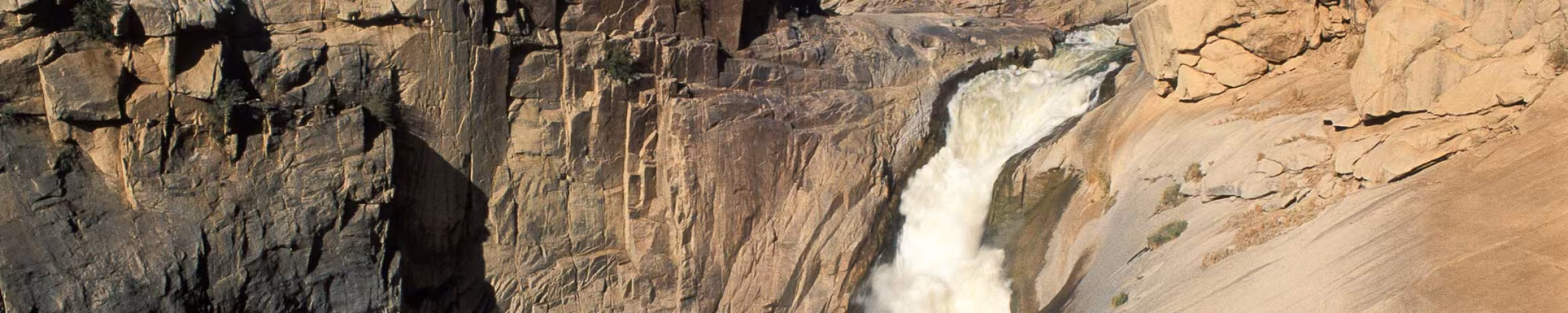
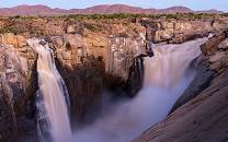
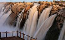
Augrabies Falls National Park protects a starkly scenic landscape of giant granite domes coursed through by the Orange (Gariep) River. Its centerpiece is the 56m-/184ft-high Augrabies Falls, which explodes thunderously at the head of a 240m-/787ft-deep, 18km-/11mi-long gorge. A network of boardwalks overlooks the waterfall. The rest of the park can be explored by car, mountain bike or walking.

-
 Best Time To Go
- April to September (Not too hot)
-
 High Season
- Never ( Only busy during school holidays)
-
 Size
Size
- 820km² / 317mi²
-
 Altitude
-
426-881m /1,398-2,890ft
 View Photos
 View Photos
+24
Photos
View Photos
+24
Photos
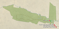 Open Map
Pros & Cons
- Ruggedly photogenic scenery centered on a spectacular waterfall
- Activities include overnight hikes, day trails, mountain biking and rafting
- Excellent birding, strong on and dry-country specials
- Off the beaten track, with great wilderness appeal
- Affordable self-catering rest camp with a restaurant
- Malaria-free
- Not much wildlife present
- Far away from South Africa’s main tourist attractions
- Can be very hot in summer
Wildlife
Of the , only leopard are present, but sightings are rare. Other large mammals include giraffe, , , , , and . The colorful , which only occurs within 100km/62mi of Augrabies, is abundant on the rocks above the falls. , , and scamper around the rest camp. The park supports a long list of dry-country birds.
More about Augrabies Falls National Park’s wildlifeScenery
This remote park is popular with photographers. The waterfall is an obvious highlight, and you’ll be in no doubt as to why it is named Augrabies, which derives from a local Khoi word meaning ‘Place of Great Noise’. Elsewhere, Moon Rock is a massive exfoliated granite that can be climbed for an eagle’s-eye view over the park. Deep gorges and cliffs add interest, as do otherworldly-looking (quiver trees).
Activities
This scenic park can be explored by car or mountain bike along a road network that offers a fair chance of spotting wildlife. Visitors with a 4x4 vehicle can drive a 30km/19mi 4x4 trail. For hikers, the 8km/5mi Dassie Trail includes an ascent of Moon Rock, and there’s also the three-day Klipspringer Trail (open April to mid-October only). Outside the park, Augrabies Rush is a half-day river rafting trip above the waterfall.
Weather & Climate
With its to arid climate, Augrabies Falls NP is prone to temperature extremes. Summer (October to April) can get extremely hot, with average daytime temperatures of 33°C/91°F. Almost all of the annual average rainfall of 100mm to 150mm (4in to 6in) occurs during these months. Winter (May to September) is dry and pleasantly warm by day but can be frosty overnight; you’ll need warm clothes if you venture outside in the early morning or evening.
More about the weather and climateBest Time To Visit
High water levels on the Orange River means that Augrabies Falls is most spectacular towards the end of the wet summer months, typically from February to April. But as it is extremely hot in midsummer, you might want to consider visiting towards the end of this period (April is considerably cooler than December to February). The climate is most pleasant in winter (May to September), when enough water still goes over the lip of the falls to make a trip worthwhile.
More about the best time to visit